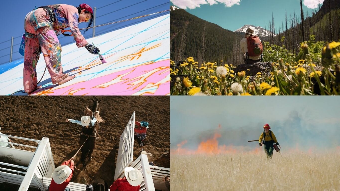
Cheap Land | Field of dreams
MESITA, Colo. — “Give us one free miracle,” Paonia-born lecturer Terence McKenna was fond of chiding his audiences, “and we’ll take it from there.”
McKenna’s statement was a tongue-in-check reference to science’s launch point from the Big Bang Theory — the notion that everything came from nothing in a single moment, with no prior indication. (He regarded this concept personally as “the limit case for credulity.”)
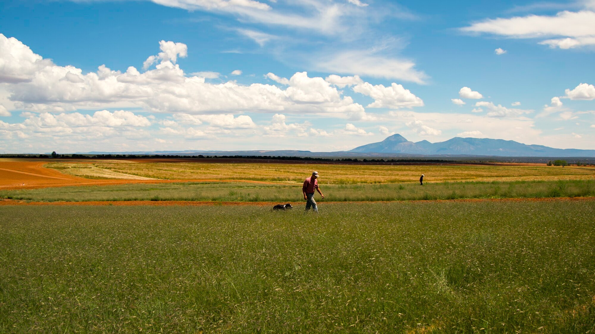
In the high desert of Costilla County, Colorado’s first settlements linger in a steady decrescendo from the eastern riparian foothills west to the Rio Grande. A sparse population still resides in this shadow of dreams, scattered across near-ghost towns among sage and prairie outlined by empty, loosely paved roads.
The “one free miracle” here?
Water.
In the late 1800s, investment firms advertised near-limitless availability of natural resources in attempt to bring immigrants and agricultural settlements to imagined hamlets and fields. A cascade of marketing heralded cheap land growing crops from the seventh-largest earthen dam on the planet.
[Related: Early marketing has led to a reckoning with Western natural resource consumption]

A 1920 census shows hundreds of people in some of Costilla County’s earliest settlements. Today, many of these communities have but a few families remaining.
“Costilla Estates saw its future in farmers being able to buy land cheap and start new lives out here,” said Ted Conover, a local resident and author whose book, Cheap Land Colorado, brought him to rural Costilla County in an exploration of today’s mostly grid-less, waterless prairie subdivisions.


Costilla Estates marketing brochures touted limitless water, easy irrigation, and endless rich soils to lure settlers west. When water sources dwindled, many of the planned communities became ghost towns.
When Dutch and German settlers balked at these sparse lands, the Estate turned to marketing to religious sects. Mormons had already settled the town of Eastdale. Now, New San Acacio was settled Presbyterian. Mesita — formerly dubbed Hamburg to entice German settlers — was settled by Methodists, and Jaroso was settled by Seventh Day Adventists.
“The developers were marketing to farmers and hoping whole communities might relocate,” Conover said. “The infrastructure built was around irrigation."
But a steady supply of settlers waned — in tandem with the water.


The town of Mesita was once called Hamburg in an attempt to attract German residents. This original Costilla Estates plan for Hamburg shows a park, schools, and residential blocks for a full-scale town. Below, Mesita today.
“It didn’t work,” Conover said, pointing out long-lost relics: the defunct railroad line, abandoned canals, an old empty reservoir. Driving past the umpteenth windowless house with sage brush sprouting from its concrete stoop, Conover waves with interest. “We're in this sort of abandoned area,” he said, truck tires scraping across the gravel terrain. “The greater dreams that once filled this place have gone away.”
Simply put, “the water wasn’t there,” said Harold Anderson, a third-generation farmer and rancher whose great-grandfather helped settle Jaroso as a Seventh Day Adventist. In 1920, some 324 people were reported on the Jaroso census. Fewer than 40 now live in the area. “They didn't know where the water was,” Anderson said of the region’s early prospectors. “They didn't really know anything when they drew the plats and put them out to the public. And they built a lot of canals — but water never made it,” he said, gesturing across the quiet, dry landscape of Jaroso.
“Sometimes I think the people who bought this land were deluded by their dreams of a new prosperity,” Conover said. "But I also think the people who developed it were deluded.”
Whether foolish or fooled, William Gilpin — a known exaggerator and purveyor of limitless natural resources — had long set the stage for the commodification of the Costilla Estates. As first territorial governor of Colorado, Gilpin facilitated large land claims and later purchased the Sangre de Cristo Land Grant, creating it into the Costilla Estate and Trinchera Estate subdivisions. In marketing the former grant, Gilpin proclaimed that irrigation was “simpler than building a fence.”
“Gilpin joined the politicians and the railroads, eager for settlers, in finding most of the plains region exuberantly arable,” his biographer Wallace Stegner wrote. Quick to dismiss the notion of the Great American Desert, Gilpin instead heralded crop-ready lands for which “rain follows the plow.”

“Irrigation is not hard work” in Colorado, according to this 1910 brochure.
Though he passed in 1894, Gilpin’s assessment of ceaseless water resources — whether his own conscious fact or fiction — remained the hinge of the company’s irrigation plans as they moved into the twentieth century. The western irrigation movement was in full force by then. Despite calls from contemporaries to fully analyze water resources before scaling reservoirs and canals, plans continued for an enormous infrastructure that could bring settlement to desert lands.
“The ‘Gilpin mentality’ was capable not only of convincing itself, but at times of imposing its fantasy upon a public and government understandably ignorant of the facts,” wrote Stegner in Beyond the 100th Meridian. He called Gilpin's plans “unreasoning, fantasy-drawn settlement and uncontrolled exploitation that Gilpin explicitly or implicitly encouraged."

An early map of the Rio Grande bordering Costilla Estates to the west in southern Costilla County.
The systems carried some water to these fringe lands, and still do today. The holdings have mostly been acquired by a handful of operations. But some of the water systems were created for communities that would never exist, or would eventually cease to exist, subsidized by desertification laws. Many miles of abandoned infrastructure still dot the once-promised landscape.
The Desert Land Act of 1877 was created to move water to supply arid irrigation systems, but less than a year later, rampant fraud caused increased rules and regulations. Funding was based on water flow and structure size, so some investors were inventing records and theorizing or fabricating stream size and irrigation capacity. Irrigation districts would now need to provide maps and plans for their work, including lists of landowners.


Abandoned water and railroad infrastructure dots the former Costilla Estate of southern Costilla County.
The Newlands Reclamation Act of 1902 created another funding opportunity to turn desert into irrigated cropland. As part of the act, Congress allowed 95% of the funds from the sale of public lands in western states to be used for irrigation projects, such as the construction of dams and reservoirs.
In the Costilla Estates, “Culebra Creek and Costilla Creek were the only water that were available,” Anderson said from his kitchen table in Jaroso. “And the Culebra River was supposed to have been over 170,000 acre feet of water. So down here, they developed 25,000 acres of ground — put ditches and canals to it.”
“And to make all of that possible, the Costilla development partners built a giant reservoir by San Luis, the Sanchez Reservoir,” Conover said.


Early irrigation plans of the Costilla Estate. Courtesy Edmond Cornelius Van Diest Papers, MS 0233, Map drawers 18, 15 and 6, Colorado College Special Collections, Tutt Library.
By 1909, the Sanchez Reservoir was underway, with water rights from several of the lower creeks transferred from acequia holdings into shares by way of the courts and then tied to lands developing east.
“When they first started developing Sanchez Reservoir in the Culebra Watershed, two years’ worth of actual figures is what they allowed the water company to base their claims on,” Anderson explained. To bolster water claims to supply their field of dreams, the estate company filed against half the area’s preexisting acequia water rights.
“But it never filled up. The water never really came,” Conover said. “Most of the plans for irrigating this land eventually dried up.”
Against the endless prairie, Conover pointed to an obtuse grassy hole. “The remnants of some of the reservoirs and irrigation ditches are all around here,” he said of the incomplete system.

An abandoned reservoir during a rainy season in the former Costilla Estate.
“Some of these things were put in that really never worked at all,” said Tom Stewart, District 24 Water Commissioner. The original plan to irrigate the Jaroso area, Stewart explained, involved water from Sanchez Reservoir traveling dozens of miles from the stabilization pond south of San Luis, down the mesa to Costilla Creek in New Mexico, tying into a canal diversion and jutting back north.
“But from the stabilization pond to that diversion on the river, well, water never got there,” Anderson said. “Not one time. Grandpa said they spent three weeks trying to get water past an alluvial slide.”
Without irrigation in the high desert, life is “just about impossible,” acknowledged Craig Cotten, Division Three Water Engineer for the Colorado Division of Water Resources. “We are in a desert and a drought situation. We have water in the mountains, and we need water in the plains and in the valleys. Getting that water to the locations that farmers and ranchers need is a unique situation. It’s something that they've worked on for the last 200 years, constructing these waterways.”
“Why did they leave? It’s pretty simple — they ran out of water,” Anderson said. “If you can't raise your crop, you can't stay there.”
His children are the fourth generation in Jaroso. “We've learned to live under these constraints,” said Anderson of their farming operation. “If you plant a hardy enough alfalfa, it stays dormant till you get water. And it's hardy enough in the fall of the year that you don't have to keep it alive.”
Standing just miles from the Rio Grande, Stewart points to where Culebra River water was once intended — a pipe running under what are now abandoned railroad tracks. A large, concrete flume adorned with gullies whispered of ages gone past. Stewart shook his head.
“I can't imagine there was as much water as they planned for,” said Stewart. “Water makes people have dreams, for sure.”

This article is part of a series. “Colorado Voices: Cheap Land Part One” premiers on Rocky Mountain PBS and our Youtube Thursday, February 9 at 7 p.m. “Cheap Land Part Two” airs February 16 at 7 p.m.
Kate Perdoni is a Senior Regional Producer with Rocky Mountain PBS and can be reached at kateperdoni@rmpbs.org.
Related Stories
Looking south to Ute Mountain.